Niangua River

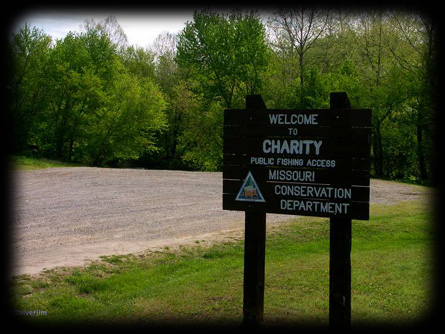
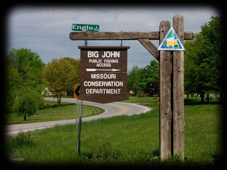
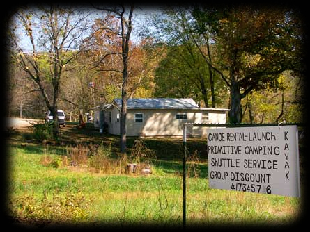
Enjoy trout and big bass fishing or just
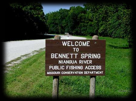
canoe or kayak down the beautiful Niangua River.

FLOATING DOWN THE NIANGUA RIVER

(Average stream gradient.)


Hwy. M to Hwy. 32-------------------6.0
Hwy. 32 to Hwy. K Bridge------------4.2
Hwy. K Bridge to
Bennett Spring State Park-----------4.1
Bennett Spring State Park to
Properine Access----------------------3.5
Properine Access to Mill Creek-------5.2
Mill Creek to below Tunnel Dam------3.0


RIVER MILES

0.0
MDC's Charity Access

Location 37.519799, -92.983844
on Hwy. M, 3 miles west of Hwy. 38, in Dallas County. No camping.
Alitude 1070 Ft.

0.3
Cline Ford

6.5
Hico Slab

Location 37.570309, -93.007725
at Dallas County Road 203. Hwy. H Turn east on Darter Rd. 1.1 miles, turn north go .42 miles, turn east .8 miles.
Alitude 1027 Ft.

8.5
Del Marlin Ford

11.5
Deusenberry Creek

11.5
Gaunt Ford

13.4
MDC's Blue Spring

Location 37.601473, -93.013805
At Dallas County Hwy. H, turn east on Chicago Rd. go 0.9 miles, turn south Falling Rock RD.go 1.0 miles, turn left Blue Spring Cir 0.4 miles.
Alitude 990 Ft.

15.0
Crane Ford

20.0
RiverJim

Location 37.634573, -93.026753
4 miles east of Buffalo.
Alitude 970 Ft.

20.0
State HWY 32 Bridge

4 miles east of Buffalo.

21.5
MDC's Big John Access

Location 37.641586, -93.043967
Hwy. 32 turn north on Engle Rd. go .4 of a mile turn east on Steelman Rd. go .8 of a mile.
Alitude 968 Ft.

23.4
Greasy Creek

23.5
Wimberly Ford

25.0
Old Watermill Bridge site

28.4
Durington Creek

30.0
Dallion Ford

31.5
Hackler Ford

33.0
Williams Ford Access

Location 37.692380, -92.955416
Alitude 922 Ft.
2.3 miles from Windyville
Alitude 922 Ft.

34.7
Indian Creek on left

37.0
Hwy. K-P Bridge
Fourmile Creek on right

Location 37.683752, -92.924209
2.3 miles from Windyville
Alitude 902 Ft.

39.5
McKee Buff on right
Cave in Buff

39.7
Saltpeter Cave in bluff on left.

Large entrance makes good shelter which was used by Indians. Pick marks from mining are still visible in one passage. Cave is small but has two levels and one of the best examples of a cored dome pit in the state.

40.1
Cave Creek

42.3
MDC's Moon Valley Access

Location 37.701998, -92.881368
Alitude 881 Ft.

45.0
Hildebrand Ford

45.5
Hildebrand Bluff on left
cave in bluff

48.0
Cat Hollow on left
small cave

49.5
Bennett Spring State Park

spring branch on right.
Cabins and camping available.

49.8
Hwy. 64 Bridge.

50.2
MDC's Bennett Spring Access

Location 37.744687, -92.860231
Alitude 844 Ft.

50.5
Danceyard Creek on right.

56.2
Spring branch on right.
River turns abruptly left along bluff

57.0
MDC's Barclary Springs

Location 37.788001, -92.861668
Alitude 812 Ft.

58.0
Low Gap.
Fast rocky riffle area

58.3
Old bridge piers.

60.0
Gilbertson Ford.

60.8
MDC's Prosperine Access

Location 37.798317, -92.836894
Alitude 790 Ft.
Eldridge 5 miles east on county gravel road to Hwy. NN

62.0
Indian Grave Point on right.

64.0
Guthrie Bluff on right.

64.9
McPheters Ford.

67.4
Smith Ford.

23.4
68.0Blue Spring on right.

70.7
Mint Spring on left.

73.8
MDC's Leadmine CA. Access

Location 37.863678, -92.897783
Alitude 741 Ft.
Primitive camping.

74.0
Lakes Creek

74.3
MDC'sLeadmine CA. Access

Location 37.861324, -92.913119
Alitude 739 Ft.
Primitive camping.

76.1
Mill Creek on left.
Settlement of Celt 0.7 mile west

77.1
Bery Bluff on right.

23.4
79.1A B Creek on left.

81.1
Chapel Bluff on left.

81.9
Lake Niangua backs water to this point.

83.3
Woolsey Creek

84.5
Lake Niangua Boating Access

Location 37.934330, -92.852078
Alitude 710 ft.

84.6
Tunnel Dam

Bypass access below dam on Camden County Road D-187

85.0
Sanderson Bluff on left

86.6
Whistle Bridge

Location 37.937950, -92.875672
Alitude 685 ft.
Edith one mile north

88
Nettles Bluff on right

90.6
Power house

91.0
Stone Ford

92.0
Darby Bluff on right

92.5
Baker Bluff on left

93.0
Stover Bluff on left

93.5
Rooffener Bluff on right

94.6
Lake of the Ozarks boundary

Look for sign.
Lake regulations apply from this point down stream. (River-like conditions will continue for the next several miles.)

95.5
Onyx Cave on left

97.6
Bank Branch

99.5
Ha Ha Tonka State Park

Location 37.973941, -92.775052
Alitude 660 ft.

108.0
Little Niangua Arm
of Lake of the Ozarks.

113.8
Niangua Arm merges with the Osage Arm of Lake of the Ozarks.

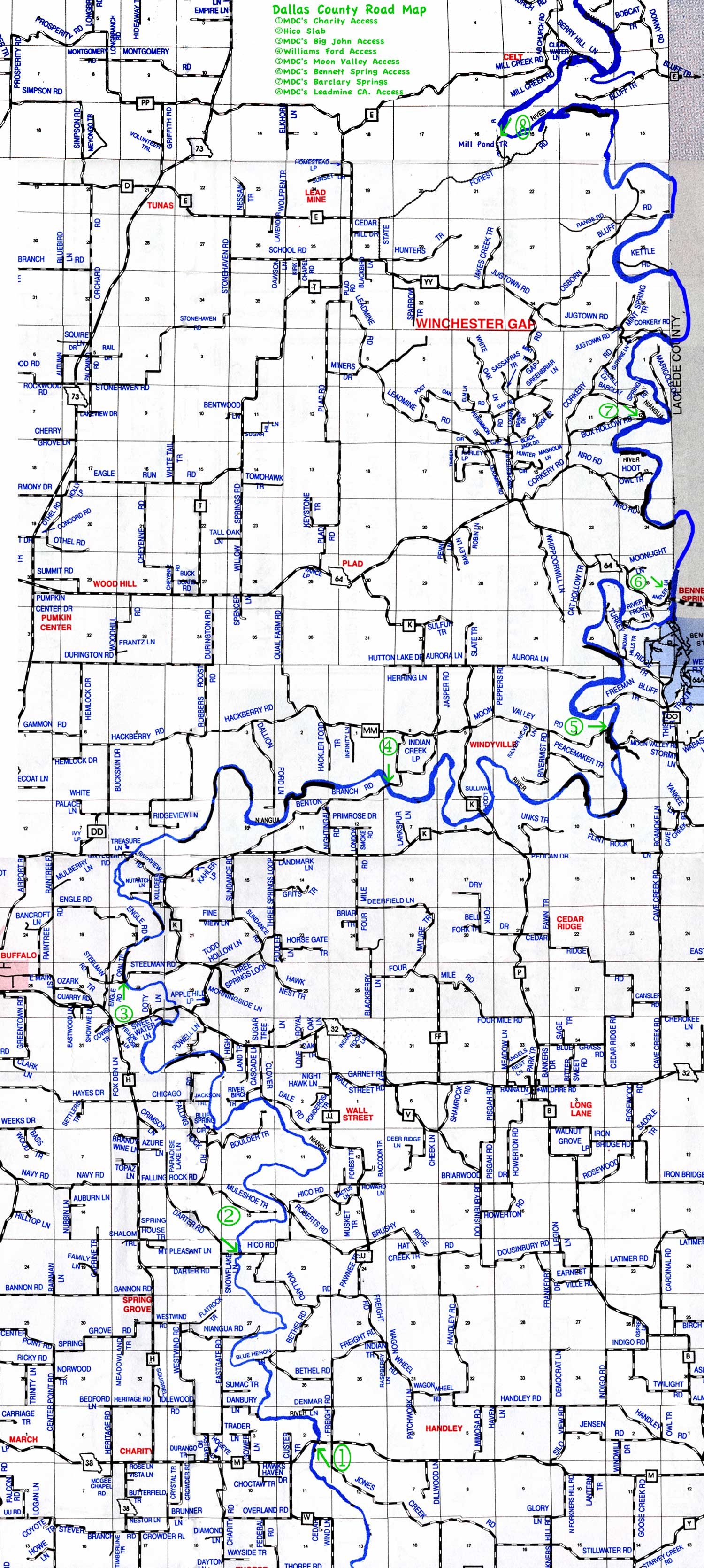
Click on photo for map of area
MDC's Charity Access
Location 37.519799, -92.983844
On Hwy. M, 3 miles west of Hwy. 38.
Alitude 1070 Ft.

Dallas County map


Hico Slab
Location 37.570309, -93.007725
Hwy. H Turn east on Darter Rd. 1.1 miles, turn north 0.4 mile, turn east 0.8 miles.
Alitude 1027 Ft.

Dallas County map


MDC's Big John Access
or Steelman Slab

Location 37.641586, -93.043967
Hwy. 32 turn north on Engle Rd. 0.4 mile, turn east Steelman Rd. 0.8 mile.
Alitude 968 Ft.

Dallas County map


Williams Ford Access
Location 37.692380, -92.955416
Windyville west on Highway MM .7 mile, left on Indian Creek rd. 1 mile, left on Benton Branch road .5 mile.
Alitude 922 Ft.

Dallas County map


K Hwy. Bridge Access
Location 37.683752, -92.924209
Windyville south on K Highway 2 mile.
Alitude 902 Ft.

Dallas County map


MDC's Moon Valley Access
Location 37.701998, -92.881368
Windyvilly east on Moon Valley Road 2.8 miles.
Alitude 881 Ft.

Dallas County map


MDC's Bennett Spring Access
Location 37.744684, -92.860231
Bennett Spring State Park west on highway 64 o.1mile, turn right into Boat Access.
Alitude 844 Ft.

Dallas County map


MDC's Barclary Springs
Location 37.788001, -92.861668
Bennett Spring State Park west hwy. 64 3.7 miles, right Corkery RD 2.6 miles, right Barclay Spring RD. 1.4 miles,
Alitude 812 Ft.

Dallas County map


View MDC's Prosperine Access in a larger map
MDC's Prosperine Access
Location 37.798317, -92.836894
Prosperine west on Kinfolk Rd. 3 miles
Alitude 790 Ft.

Dallas County map


MDC's Leadmine CA. Access
Location 37.863678, -92.897783
Location 37.861324, -92.913119
Tunas east State Hwy E 3.7 miles, south State Hwy T 0.7 mile, east State Hwy YY 0.5 mile, north entrance to Lead Mine, State Forest RD. 3.2 miles, left Boat access 0.8 mile.
Primitive camping.
Alitude 741 Ft.
Alitude 739 Ft.

Dallas County map


Lake Niangua Boating Access
Location 37.934330, -92.852078
Edith turn right Whistle RD. 0.8 mile, turn left on Broads Branch 0.8 mile, turn left on Chapel Bluff RD. 1.4 miles.
Alitude 710 ft.

Dallas County map

Whistle Bridge
Location 37.937950, -92.875672
Edith turn right Whistle RD. 0.6 mile.
Alitude 685 ft.

Dallas County map

Ha Ha Tonka State Park
Location 37.973941, -92.775052.
Niangua Arm Lake of Ozark and State Hwy. 54 east 0.3 mile, State Hwy.D south 3 mIles. turn right on Tonka Springs Rd. turn right.
Alitude 660 ft.

Dallas County map